Welcome back to my second installment of our CBE Fellows blog report. Reporting live: From Galway (Gaillimh) Ireland !
I left you last time with the first stages of our project — valuing sea-floor resources, and it has come a long way. My colleagues at the SEMRU unit have been instrumental in helping me get up to speed and teaching me some tricks on GIS. At the end, we will be getting a report written to show what ecosystem services that these sea-floor habitats have in the study areas of the
EU-ATLAS Project. It’s been going very well, and this will be a great groundwork for further projects — This experience has been very academic, unlike some of my colleagues diving on reefs and working with Marine Protected Areas (MPAs).

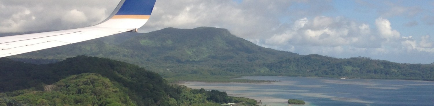
The Cliffs of Moher with O’Connell’s Fort and ferry boat.
I started this project learning some skills with a free program called Q-GIS (Geospatial Information Systems), it is essentially the open-source version of ARC-Map, the more widely used program by ESRI used for GIS mapping. There were some moments where I had to get up to speed with the different program, but as July moved on, I was making progress. I had combined data with the EU-SeaMap and EU-ATLAS Case Studies. Now, since we are working with the sea-floor, there are a lot of relative unknowns. However the data-set for the EU-SeaMap is quite detailed as to what is actually down there. That has been instrumental…however, a lot more research needs to be done on the sea-floor.
It’s far away, very far away. And very dark down there. This project has opened my eyes to some of the major challenges of sea-floor research.
First, we just don’t know. Secondly, conditions change, and connectivity between the sea-floor and other areas of the ocean are not always backed by correlation, even if it appears to influence one part, or one species, the scientific backing can be missing essential pieces of connection. Third, we’ve come a really long way since the 1980’s and research organizations like SEMRU, and the Irish Marine Institute are doing a lot of great research, but grants can be difficult to come by, and permanent positions have the same issue.
Here’s a few of the maps that I have put together. QGIS trick #1: There is a Python console which can render a world map upon your current project with the correct projection– Load up the python controller and put this in…
“qgis.utils.iface.addRasterLayer(“http://services.arcgisonline.com/ArcGIS/rest/services/Ocean_Basemap/MapServer?f=json&pretty=true”,”raster”)”
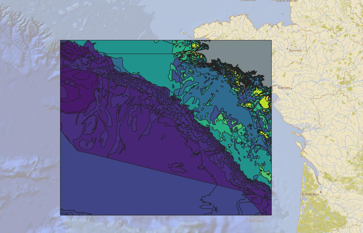
Bay of Biscay Habitats (Lighter yellows – more shallow, deeper blues and purples, deeper waters)

EU-ATLAS Study areas with sea-floor data. The grey areas did not have EUNIS Codes…..future study area ??

The case study of the Rockall Bank, with sea-floor habitats, a famous fishing region off the coast of Ireland.
These maps are showing that more shallow sea-floor is in lighter colours, whereas the deeper purples and blues are further down. Generally, the darkest colours represent areas below 200 m, or the deep-sea. These areas have very little sunlight reach them, and creatures there are generally bottom feeders of detritus or filter-feeding crustaceans, mollusks, and fish, or scavengers of the deep….
I took these maps and combined them with a report of “Expert Opinion”, from Ibon Galparsoro in 2014, from “Frontiers in Marine Science” and his team’s Ecosystem Services scores with these habitats….
We’ve found that the deep-sea contributes a lot to Ecosystem Services, but also is the largest by area, and is frequently not valued as such. The infralittoral and circalittoral substrates closer to shore provide more ecosystem services, but are fewer by a wide margin, in total area. The deep-sea is 91% of the marine biome.
Ecosystem Services are broken down into three categories: Provisioning, Regulating, and Cultural.
Galparsoro used a common separation of these into 12 factors….
Provisioning: Food provisioning, natural resources
Regulating: Air Quality, Disturbance reduction, Photosynthesis, Reproduction (Primary Production), Waste Reduction, Nutrient Cycling, Biodiversity
Cultural: Cognitive (Research and study), Leisure, Feel-Good
We’ve taken these values and broken them down into each habitat found in the EU-ATLAS Study Areas…. It’s a lot of data, I’ve admittedly worked with spreadsheets a lot here trying to understand it all. I question if I’m making a difference, but I think that’s a good feeling to have. All my colleagues here are postdoctorates, current PhD owners, and well-experienced in the marine field… I wonder if I should pursue a PhD….
Anyway, meanwhile, in Galway, July has been extremely warm, temperatures were in the 25’s and 30’s ° C (85-90 °F!). The pale and fair-skinned Irish were noticeably sunburnt, and I, a Minnesotan, sometimes hid from the sun’s rays in a local pub or at a concert. It is August, and the clime has cooled with multiple days of “Irish Summer”, aka driving rain that dumps for 30 minutes and passes for blue skies, until repeating again. I like the rain, so I’m quite happy the temperatures have come down to the 15’s and 17’s. (I’ve switched to Celsius now, by the way.)
We passed the Summer Solstice in June, where the sun rose at 5AM and set at 11PM. A gloriously warm summer for Ireland, but makes me realize the need for work in the marine realm, environmental field, climate research, all of it to be understood better. The climate in Ireland in the summer is not supposed to be this warm, for this long. A day here and there, yes, but overall, in June and July, the country was well over the average temperature. Reports indicate that this summer was one of the hottest on record already, with a massive European heat-wave causing fires in Greece, Spain, France and larger fires across the Atlantic in California, blistering temperatures in the northern hemisphere all around. And, in Japan, hundreds died in record breaking temperatures in my ancestor’s country, and landslides washed away others in Sri Lanka and India.
But, we press on, I press on, and hope that whatever research is completed, whatever becomes of this project, and whatever I can do after I graduate, in some way helps.
I digress to less depressing matters — during June and July, Galway was the host to “Seafest”, and the “Galway Arts Festival” an annual gathering of marine experts and an open festival to the public. I took advantage by networking with organizations here and taking a few tours of the research vessels in the port!
Here’s some images of the day at SeaFest (Which was, mind you, the warmest day of the month, 35°C, yikes)
 The Flag of Galway for SeaFest
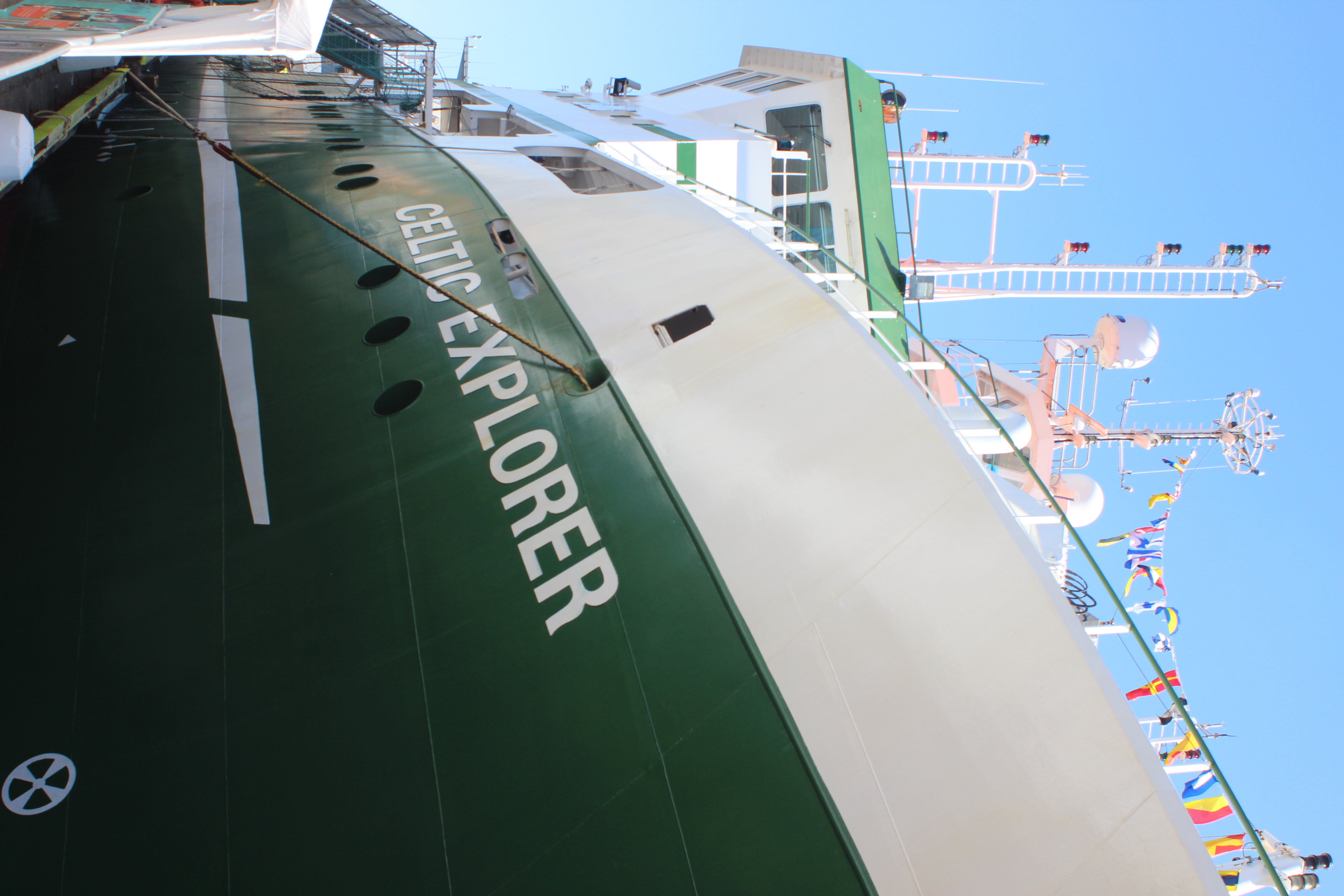 The Celtic Explorer: The sea-bed and marine research vessel of the Marine Institute.
 Irish coastal defense vessel, LE William Butler Yeats, which responds to emergencies and high-seas crimes.
 A shark made out of recycled material recovered from the oceans.
 The coast near Clifden, to the north on a brilliant partly cloudy / mostly sunny day.
 View over the coast on the “Wild Atlantic Way” road, in Conemara, to the north of Galway.
 Kayakers enjoying the port with vivid vessels on turquoise water during Seafest.
 Yours truly with a shark with strange teeth at the best fish-n-chips place in town, “Hooked”.
 A curious fish at the Galway Aquarium.
Along with the research in the office, where I spend the days, the evenings in Galway are serene, and filled with tourists. There are a lot of visitors here, and the Galway Arts Festival occurred during the end of July, while bands well-known, and not so well-known play shows. The summer months have had a lot of good craic here (Good times!) and new friends, colleagues, with a flair for music, art, and walks along the promenade. I traveled around Ireland a little to see the landscape, and some castles, visit the Burren (A biodiversity hotspot), and see some music. I am truly lucky to be on an island with such history, beauty, and an organization that matches my love for nature with opportunities like this Fellowship.
 Amadou et Mariam (Malian afro-funk musicians)
 The Rock of Cashel
 Bridge in lovely Cork
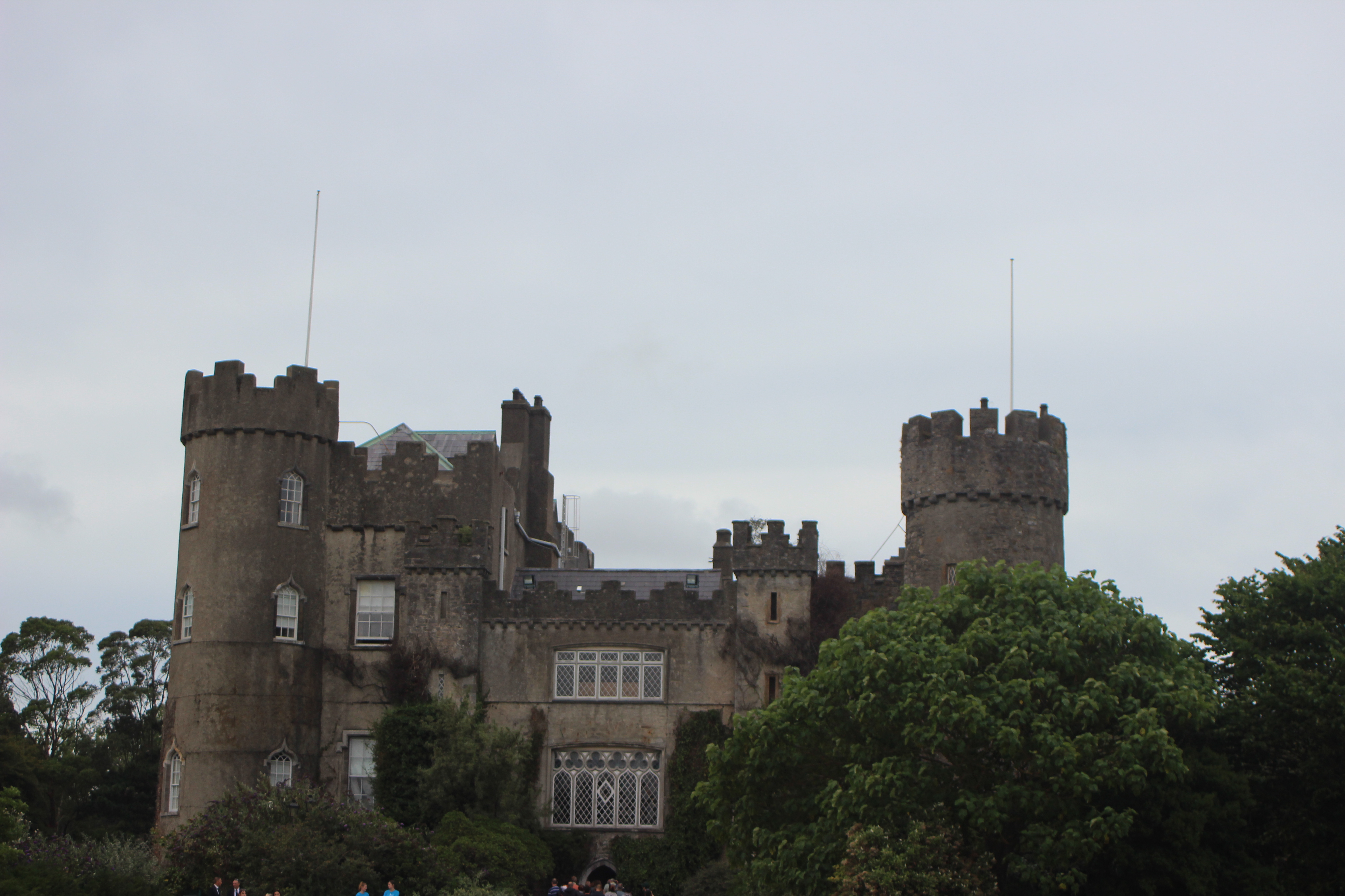 Malahide Castle (near Dublin)
I’m currently in the throes of writing the final report, which will be a group effort between myself, my superior, Dr. Stephen Hynes, a postdoctorate student, Dr. Oisin Callery, a geographer and GIS master, and his superior, Dr. Anthony Grehan, a marine scientist. That will be documented in my final blog post after I return to MIIS. Stay tuned — We’re synthesizing.
Once again, thanks for stopping by and reading, if you have any questions, don’t hesitate to reach out to me via email, and I look forward to seeing everyone back on campus in a few short weeks.
Respectfully,
Kyle Burnett
MA-International Environmental Policy Candidate Oceans and Coastal Resource Management 2019
kyleburnett417@gmail.com
+1.952.221.9417