It’s been a great summer. School has restarted and we’ve began new marine projects out in Monterey. But, back in Galway, our team came across a lot of findings and interesting data, lacuna for research, and a plethora of memories along the way. This article will be a little summary of what myself and our team found in our synthesis report, and what is next on the docket. First, take a look at a parting shot of Galway’s River Corrib on a typical Irish Summer day, (it wasn’t really cloudy most of the summer, but only the last two weeks of my stay there), the river runs out into the Galway Bay, and further, into the great Atlantic Ocean.

The Claddagh, the ring of houses around the River Corrib, and into the alway Bay.
Just coming from my side of the story, this opportunity helped me learn much, and I feel that there will be a lot more to come in the sector of deep-sea research in the future. Hopefully, I’m a part of it! It all begins with one step, and one action. These cascades into larger decisions which inevitably play a role in shaping the life each one of us live. This was but one of those steps. Join me on the next one.
All these paths we choose, no matter which direction we go, leads us to formative experiences. Sometimes they seem impossible, or barely real, but oh, dear reader, they are possible. I know that the next class of OCRM students here may read this, or may not, but mine, and my colleagues summer blogs can help to prepare for a productive summer. But for now, stay with me and read a little more about the reflection of what the Socio-Economic Marine Research Unit, and yours truly, accomplished this summer.
Let’s begin with where it all began…
The project started off of as an idea to look at Ecosystem Services from Galparsoro’s 2014 report. They scored many EUNIS sea-floor habitats to show values. All from an ‘expert opinion’ perspective.
After a week, I had compiled Table 2 form that report and given them numerical scores, along with a brand new log-in code to access SEMRU networks.
I then checked out the EMODNet / EU-Sea Map bathemetry and sea-floor habitat maps, this is where it all really began.
The project grew in scale as I was making maps with the entirety of the EU-Sea Map locations with Galparsoro’s scoring. Going over this data took a while. 3 weeks had passed.
We had some questions about how ideal this was, so we decided to lower the scope and focus solely on EU-ATLAS Project case studies — which was part of the Marine Science Group at the university. (National University of Ireland in Galway, NUI-G)
Afterwards, I was instructed to multiply the area by the scores to get aggregate numbers. This is a flawed methodology which shows flaws, so after another two-weeks of data and mapping, we scrapped that idea and needed fishing indicators.
Speeding to the finish, I looked at fishing economic indicators from the International Council on the Exploration of the Sea (ICES) and our original EU-ATLAS Case Studies.
I finally got the direction down, but by this time it was the last week. So I synthesized most of the work together when I got back to Monterey, and have finished writing the first draft of the report.
Here’s what we found out.
In our three case studies where ICES fishing landings were available, the Rockall Bank, the Porcupine Seabight, and the Bay of Biscay, we found that Galparsoro’s estimates of sea-floor scoring for food provisioning (only) matched up where actual demersal species were being taken from (using vessel monitoring systems – VMS – and economic landings totals.)
Check out these maps to show the data graphically.


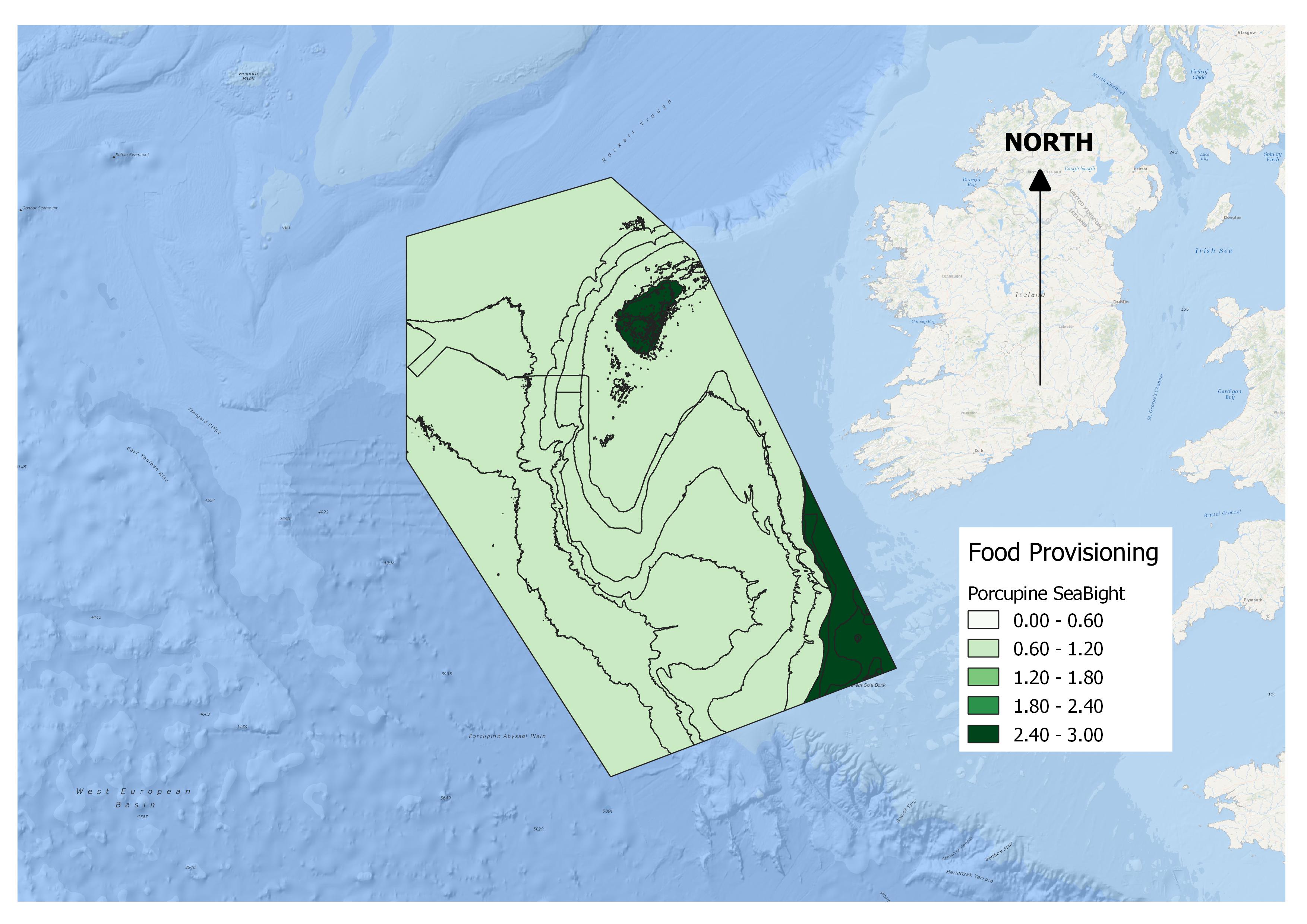
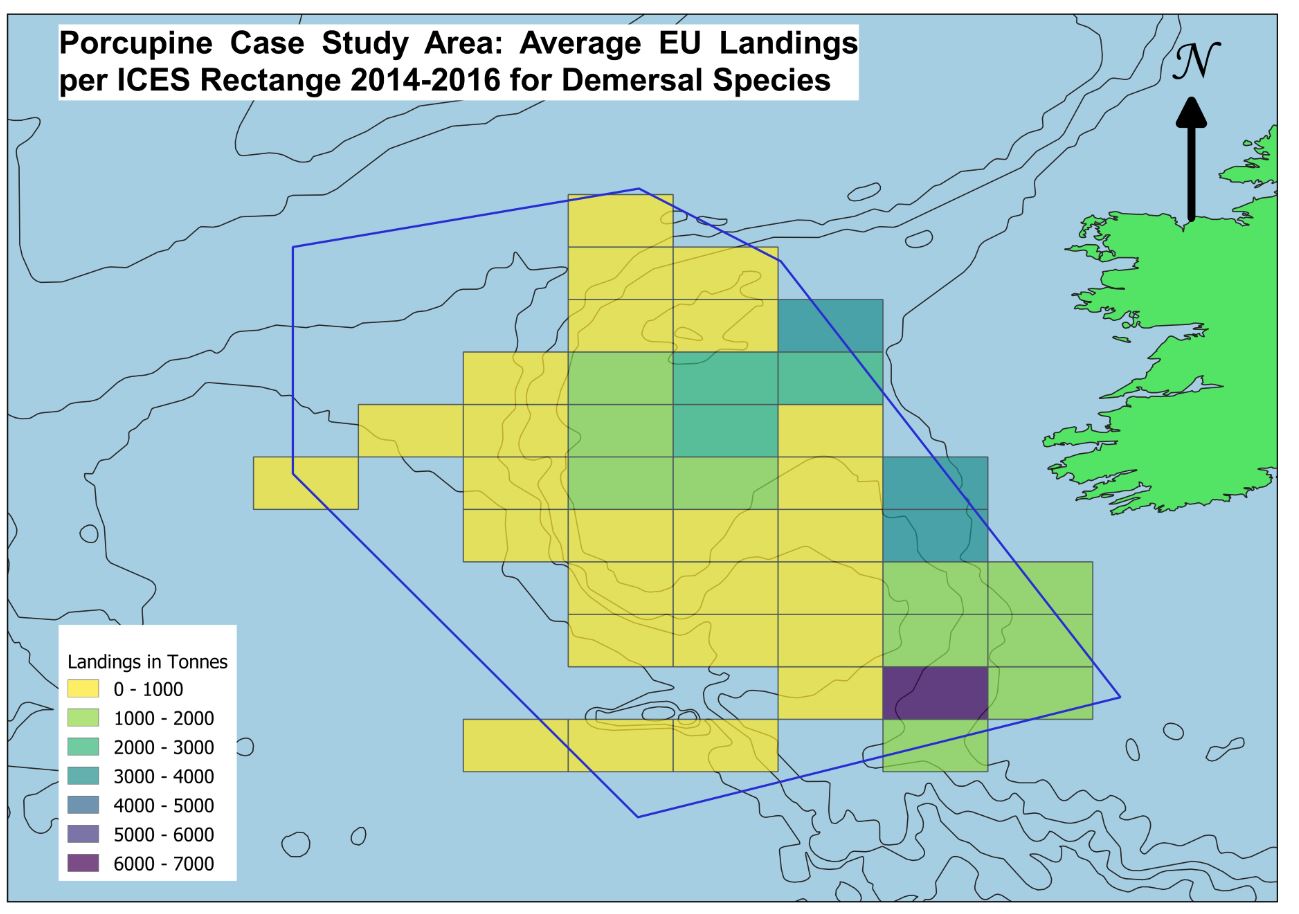
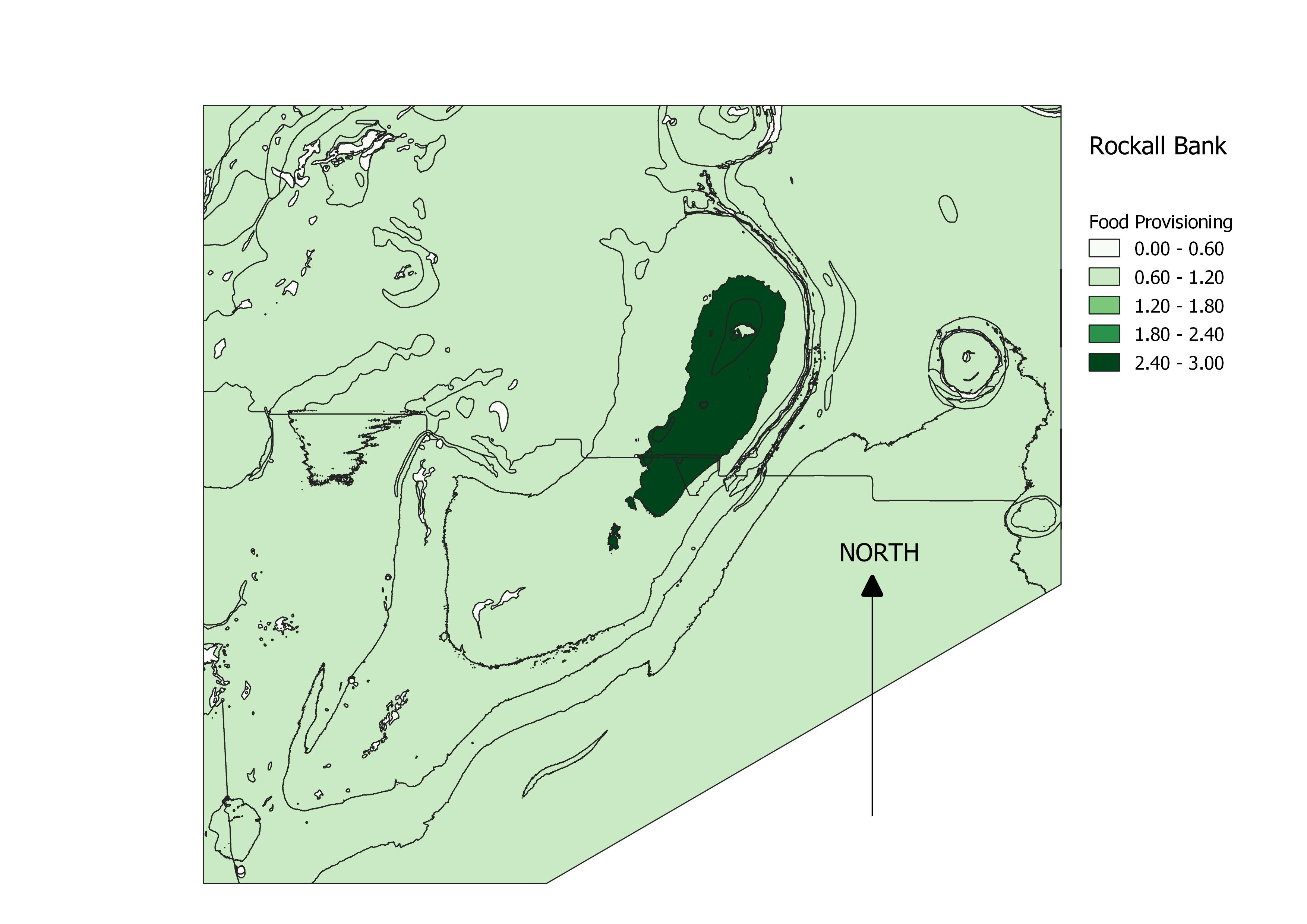

What we see here is that areas on the left set of graphs are sea-floor habitats with high scores for food provisioning via Galparsoro 2014.
The right column indicates the ICES demersal (Or sea-floor and benthi-pelagive — very close to sea-floor) species landings.
It’s pretty clear, the scoring from Galparsoro and our ICES data match up pretty closely. Not exactly, but there area few artefacts from the mapping process.
This is very encouraging for the rest of Galparsoro’s report, if their scores are correct for all 12 Ecosystem Services Factors (Food Provisioning, Raw Materials — Disturbance reduction, Photosynthesis, Biodiversity, Reproduction from primary producers, Waste dilution, Nutrient cycling, and Air Quality — Cognitive Study, Leisure, and Feel Good).
[the first group are provisioning, the second are regulating, and the third are cultural ecosystem services)
If these ES Factors can be synthesized with scientific data and projected in reports like this one, there can be a lot more insight into how accurate these Ecosystem Services Scores are for the the big picture. And when we’re trying to value the vast open ocean, the deep-sea, and the high-seas, every bit of valuation information is necessary, invaluable, and in high demand.
This is a great simplification of the work we did, but the SEMRU team were accommodating and very informative, professional and forthcoming. I was impressed with the work I was put on and feel that in time, this could be a great project to study with more focus. PhD, Burnett ? Could be… could be…
I want to personally thank you for following along with my CBE Blog this summer, and a bit beyond, and hope that when it comes to making your decision on a CBE Fellowship, you take into account what is best for you, but also consider the possibilities of Ireland, and what it could be for you.
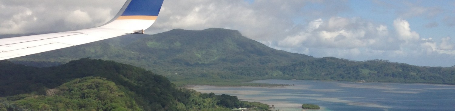
I’ll leave you with some final pictures of a seabird in flight, a coral beach, and the wing from my flight home, and as always, I am eager to chat if you have any questions about the CBE Fellowship, or any general questions about our Institute (MIIS). Or music, if you want to talk about music, I’m always ready.
Respectfully,
Kyle Burnett
keburnett@miis.edu // kyleburnett417@gmail.com
+ 952 221 9417